


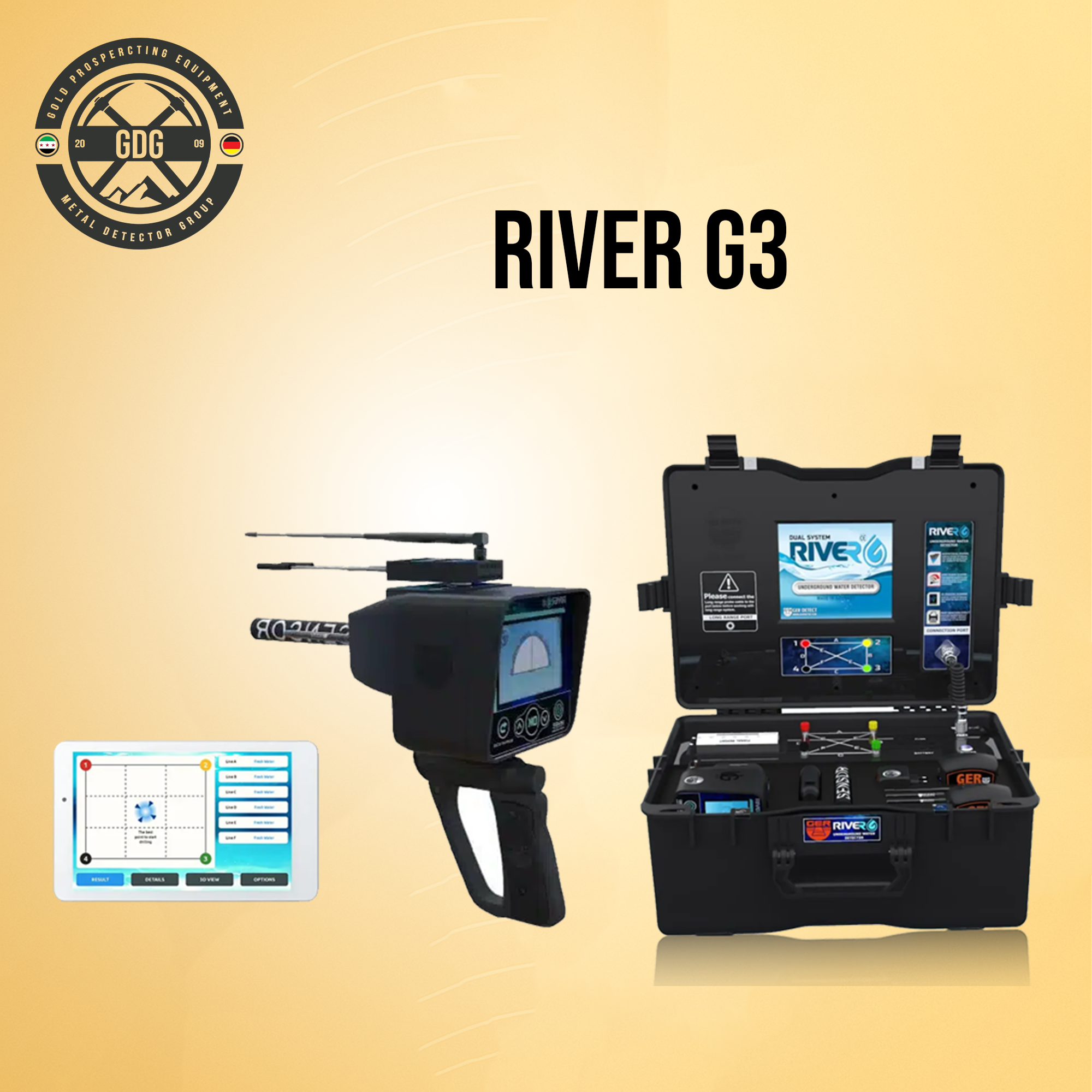
River G Groundwater Detection Device
The River G is a unique, world-class device featuring three systems to detect groundwater, artesian wells, and borewells underground: 3D Imaging System, Geophysical Search System, and Long-Range System.
Key Features
- Depth: up to 1500 meters underground
- Front range: up to 3000 square meters
- Determines water type: fresh, salty, very salty
- Select continent and country for targeted searches
- Works worldwide with six soil types: rocky, natural, mixed, mineralized, clay, sandy
- Displays rock percentage within the scanning area
- High-quality 3D imaging of water and rocks location
Systems
3D Imaging System
Provides detailed 3D images of underground water layers and analysis results, showing water type, depth in meters, and best digging points. Includes a pie chart indicating density, rocks, and salinity ratios.
Geophysical Search System
One of the most powerful systems for fast, accurate water detection. Displays precise details about water depth, density, salinity, and type (fresh, salty, very salty).
Long Range System
Highly accurate for detecting water in vast areas. Features a high-resolution color touchscreen, digital compass, and supports six languages: German, English, French, Spanish, Italian, Arabic. Users can select soil type and set front range (500 to 3000 meters) with a depth of 1500 meters. Guides the user directly to the target, confining it within a 1 square meter area.